High Level Significant Weather Maps
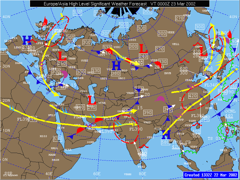
High Level Significant Weather Forecast

Features: (FL240 to FL600)
Jetstreams – Solid yellow lines. Wind flow in direction of arrow. Max wind speeds indicated with wind flags. Altitude of jetstream indicated with FLxxx label, where xxx is altitude in hundreds of feet MSL.
Surface Fronts – Cold front is dark blue. Warm front is red. Occluded front is purple. Stationary front is alternating red and dark blue. Surface trough is purple.
Turbulence Areas – Dashed red lines. Intensity and altitude range are indicated with turbulence symbol and altitudes in hundreds of feet MSL.
Convective Areas – Scalloped green lines. Coverage of area indicated with labels along with maximum tops in area. ISOL CB indicates less than 1/8 coverage. OCNL CB indicates between 1/8 and 4/8 coverage. FRQ CB indicates 5/8 coverage or greater.
Tropopause Heights – 3 digit number inside of white box. Depicts altitude of tropopause in hundreds of feet at that location.
Volcanic Ash – Scalloped white lines. Altitude range of ash is labeled in hundreds of feet MSL.
Tropical Systems – Tropical Storms and Hurricanes/Typhoons/Tropical Cyclones are depicted with red standard symbols (open body indicates wind speed less than 65 kts, solid body indicates wind speed of 65 kts or greater. The position on the map indicates the forecast position of the storm at the valid time of the map.
Map depicts 12 hour high level significant weather forecast conditions between FL240 and FL600, including surface fronts, turbulence areas, convective areas, jetstreams, tropopause heights, and tropical cyclones and volcanic ash when present.
Maps are created at 0130 (valid at 1200) UTC, 0730 (valid at 1800) UTC, 1330 (valid at 0000) UTC, and 1930 (valid at 0600) UTC. Jeppesen meteorologists create these forecast maps using NWS and UKMO numerical guidance, satellite imagery and current observations.
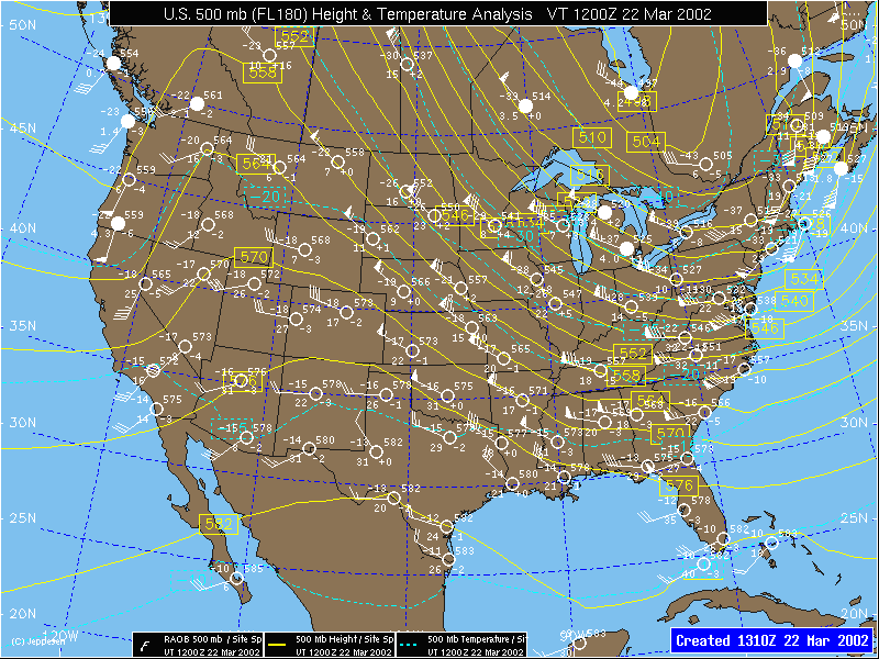
Upper Level Analyses

Features
Map Levels - Flight Level Pressure Level
050 850 mb
450 150 mb
Height Contours – Solid yellow lines depict contours of geopotential height at the standard pressure level. Lines are labeled with the 3 digit height in decameters (570 represents 5700 meters on the 500 mb map). Lines are drawn at 120 meter intervals for 150, 200, 250 and 300 mb maps, 60 meter intervals for 400 and 500 mb maps, and 30 meter intervals for 700 and 850 mb maps.
Isotachs (150, 200, 250, 300 and 400 mb maps) – Light blue dashed lines depict contours of wind speed in knots. Lines are drawn at 20 knot intervals.
Isotherms (500, 700 and 850 mb maps) – Light blue dashed lines depict contours of temperature in degrees Celsius. Lines are drawn at 5 degree intervals.
Station Data – Radiosonde observation data is depicted in white at selected locations. Station circle is filled if the temperature/dew point spread is 5 degrees Celsius or less. Temperature is depicted to the upper left of circle. Dew Point depression is depicted to the lower left of circle. Geopotential height in decameters is depicted to the upper right of circle. Change in geopotential height in decameters over the past 12 hours is depicted to the lower right of circle. Wind speed and direction are depicted using standard wind flag at station.
Maps depict upper level geopotential height contours and wind speed (above 500 mb) or temperature (500 mb and lower) at standard pressure levels (850, 700, 500, 400, 300, 250, 200, 150 mb).
Maps are valid at 0000 and 1200 UTC each day, and sometimes at 0600 and 1800 UTC when intermediate observations are taken. Maps are created at 1310, 1910, 0110 and 0710 UTC and contain the most recent observations and analysis available.
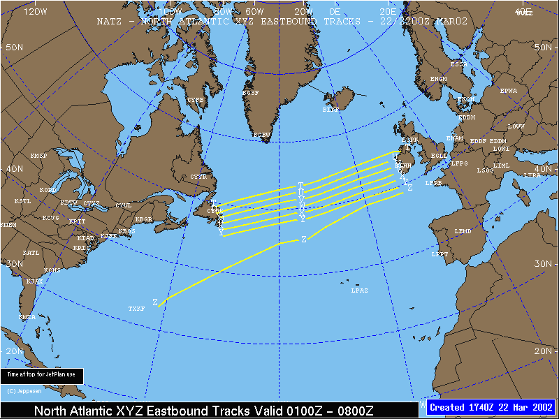
North Atlantic Tracks

Map graphically depicts the twice daily ABC and XYZ North Atlantic Tracks. Solid yellow lines represent the individual tracks, and the track is labeled with the corresponding letter.
Maps are valid from 1130 to 1800 UTC for the ABC westbound tracks and created at 2300 UTC the previous day, and valid from 0100 to 0800 UTC for the XYZ eastbound tracks that are created at 1600 UTC the previous day.